
Parcel map from official German cadastral data
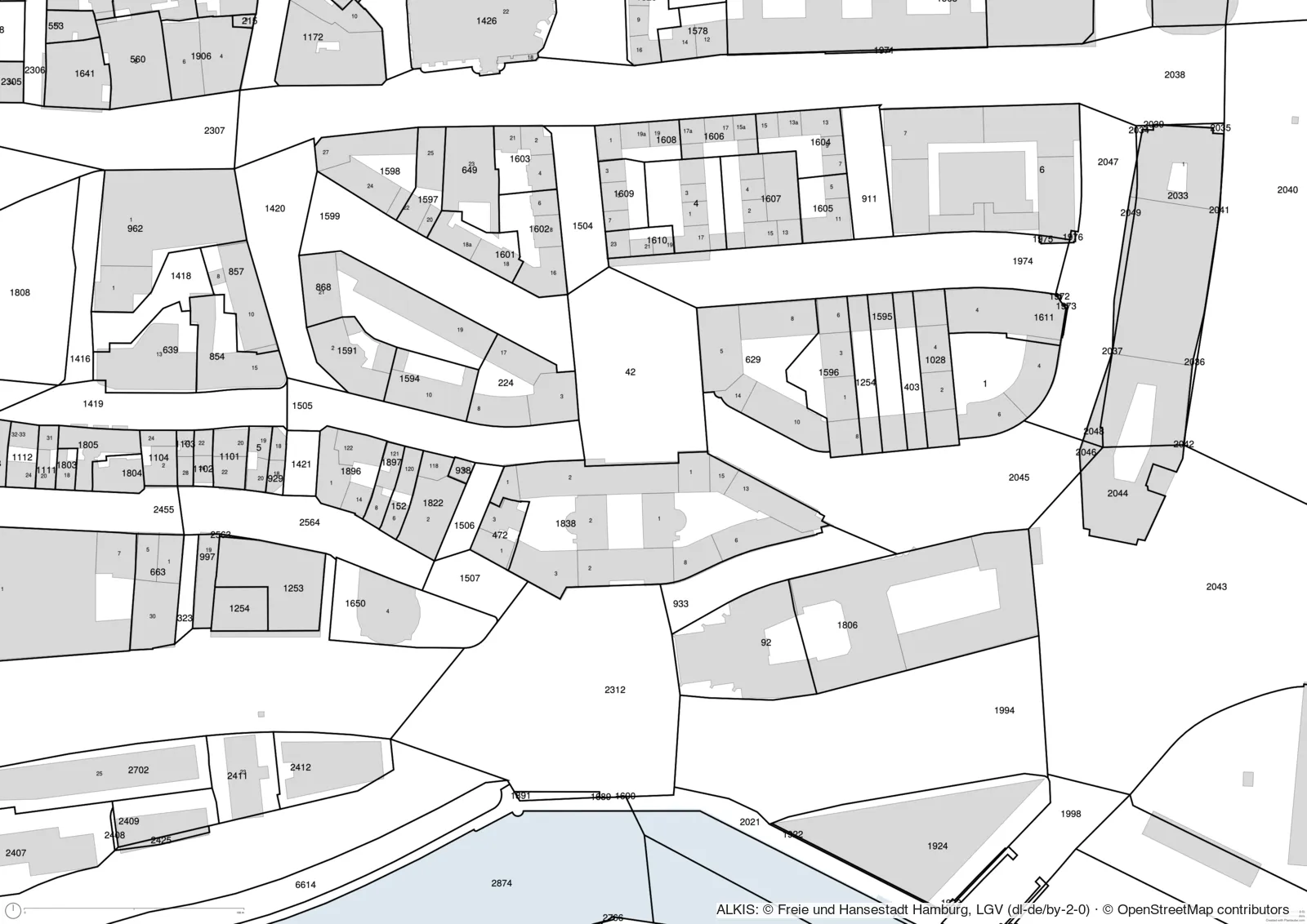
Plot boundaries and parcel numbers straight from the official German land register (ALKIS), combined with buildings and house numbers, to scale and ready to export.
Start with this templateOpens Plantaube with the template applied. Free, no sign-up.
What is a parcel map?
A parcel map (Flurstückskarte) shows the boundaries of individual land parcels and their numbers. It is how you identify a plot, check who owns what, or place a design on its site.
Plantaube fetches parcels from the open ALKIS services of the German states and works out from the map which state is responsible. This works everywhere in Germany except Bavaria, Schleswig-Holstein and Saarland, which do not publish their parcels as an open service.
What it’s for
Plot research
Quickly find the parcels and their numbers around a site.
Design base
Boundaries as a base for early design and feasibility studies, also as DXF.
Development
See connected land and neighbouring parcels at a glance.
How to make it in Plantaube
- 1Search for a place in Germany, then choose paper size and scale.
- 2Click “Continue to Adding Layers”: buildings and the right state’s parcels load.
- 3Adjust line colours, fill and labels in the “Parcels (ALKIS)” layer.
- 4Export as PDF, SVG, PNG or DXF.
Frequently asked questions
Which German states are covered?
Every state whose survey office offers ALKIS as an open service – currently all except Bavaria, Schleswig-Holstein and Saarland.
Does this replace an official site plan?
No. The data is official, but the plan is not a certified extract from the land register. For a building application you still need the official site plan or extract from the land registry or a surveyor.
What attribution is needed?
The state survey office, for example “© GeoBasis-DE/LGLN”. Plantaube shows the right credit for each state right in the map.
More plan types
Site plan
The colourful Plantaube standard: buildings, trees, green space, water and land use.
Public transport map
Metro, rail, tram and bus lines with their stops – around any location.
Aerial photo plan
Official aerial photo with building outlines – to scale.
Figure-ground plan
The urban fabric at a glance: black buildings on a white ground.
Urban design plan with shadows
Building masses with floor counts and cast shadows – competition style.
Property location map
A neighbourhood map for listings, with the property highlighted.
Dark site plan
Greyscale on a dark ground – for presentations and screens.