
Urban design plan with cast shadows
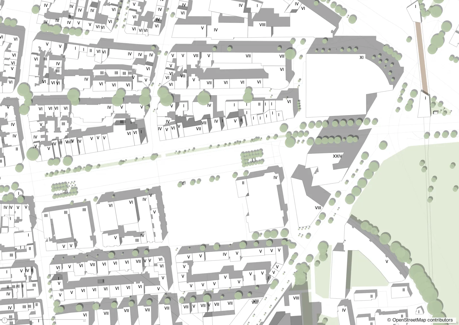
White building masses, floor counts and cast shadows that make heights readable: the classic urban design site plan, for any place in minutes.
Start with this templateOpens Plantaube with the template applied. Free, no sign-up.
What makes this plan
An urban design plan shows buildings as masses labelled with their number of storeys – in Plantaube as Roman numerals, as is common in German practice. Cast shadows make the height profile of a neighbourhood readable at a glance.
Shadow length follows each building’s floor count. Where OpenStreetMap lacks it, you add it with a click. Choose direction and length freely, or let Plantaube compute the real sun position for a date and time at the site. Trees cast their own shadows.
What it’s for
Competitions
Site plans for competition entries and jury presentations.
Design
Check how heights and spacing sit within the existing fabric.
Engagement
Clear plans for public consultations and committees.
How to make it in Plantaube
- 1Search for a place and choose paper size and scale – typically 1:500 to 1:2000.
- 2Click “Continue to Adding Layers”: buildings, trees, green space and water load and shadows are cast.
- 3Fill in missing floor counts and set the sun position or shadow angle.
- 4Export as PDF, SVG, PNG or DXF.
Frequently asked questions
How accurate are the shadows?
Shadows follow the buildings’ floor counts and the chosen sun position. They illustrate overshadowing well but are not a daylight study such as one required for EN 17037 compliance.
Where do floor counts come from?
From OpenStreetMap. Where they are missing, Plantaube highlights the buildings and you can enter the storeys right on the map.
Can I change the style?
Yes. Colours, line weights, shadow opacity and the position of floor labels can be set per layer and saved as your own template.
More plan types
Site plan
The colourful Plantaube standard: buildings, trees, green space, water and land use.
Public transport map
Metro, rail, tram and bus lines with their stops – around any location.
Aerial photo plan
Official aerial photo with building outlines – to scale.
Figure-ground plan
The urban fabric at a glance: black buildings on a white ground.
Parcel map
Official German cadastral parcels (ALKIS) with numbers, buildings and house numbers.
Property location map
A neighbourhood map for listings, with the property highlighted.
Dark site plan
Greyscale on a dark ground – for presentations and screens.